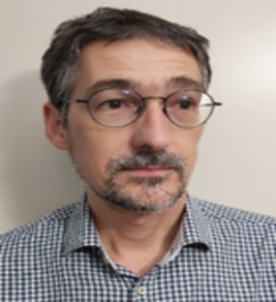
Matteo Crozi
Researcher
|
Matteo Crozi (male) Matteo Crozi (male) receveid in 2003 a PhD in Geodesy from the Politecnico di Milano, Italy. Consolidated experience in the field of Geographic Information Systems through the advanced use of ESRI products (ArcInfo, ArcView) and OpensSource (QGis). Higher level knowledge in the use of GIS software in the Web environment, i.e. in the management and implementation of programs and procedures for sharing geographical resources via the web. Knowledge of GPS instrumentation with experiences of survey on the ground in both static and kinematic mode; many years of experience in the field of photogrammetry applied to the following sectors: architectural, geological, paleontological and cultural heritage; both terrestrial and aerial by UAV. Use of software dedicated to the modeling of building (BIM) through the use of data detected by terrestrial laser scanners and by restitution from terrestrial photogrammetry. Project management skills in the cartographic field (from design to testing) with coordination in both local and national groups. |


